A lovely walk along leafy lanes and little-known footpaths, exploring deep into the Trinity countryside
Walk Details
- 50 Minutes
- Starts at: Trinity church
- Ends at: Trinity Arms public house
- 2 miles
- Beginner
This church is one of the 12 medieval parish churches of Jersey. Trinity Church has been central to the life of the parish community for hundreds of years and is a major feature in the landscape.
Leaving the churchyard by the steps opposite the main entrance, carefully cross the main road and take the lane opposite called La Rue de Mont Pellier.
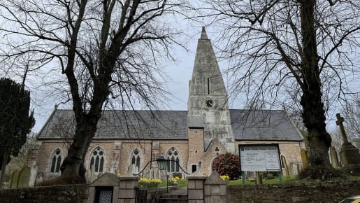
Trinity Church
Enjoy the stroll down this picturesque lane that was the winner of Jersey’s first ‘Scenic Lane’ competition in 1997. On the righthand side, you will pass the rear of Trinity School. This is one of the Island’s Victorian parish schools and it was unusual in having two separate schoolrooms. The southern schoolroom was built in 1854 out of Mont Mado granite, with a small bell tower to call children to their classes. The second schoolroom was built in a similar style in 1897.
A little further on you will pass the picturesque entrance to Mont Pellier with its double arch
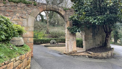
Mont Pellier double arches
Mont Pellier is a traditional granite property dates from the 17 th century and was owned by the Pellier family. The first member of the family to arrive in Jersey was Gabriel Pellier, a Huguenot refugee from France. Gabriel died in Trinity in 1704 and his son, Daniel, married Marguerite Richardson in Trinity on 29 October 1715. A datestone with their initials features in the cider press house on the property. Note the granite apple crusher just beyond the entrance, a reminder of the Island’s important cider making heritage.
Immediately before the next junction, turn left onto a steep footpath signposted Le Ruelle ès Biches.
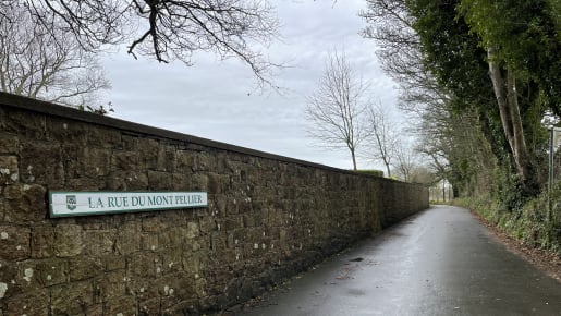
Mont Pellier sign
Follow this long footpath, whose name means ‘nanny-goat’ in Jèrriais, as it runs between two traditional Jersey farmsteads. On the right is Augrès Farm and you can spot the curved outer wall of the tourelle staircase to the rear of the property. On the left is Les Cotils Farm with an attractive wooden bell tower on its roof. As you enjoy the scenery, look out for wildlife in the trees and hedgerows to either side. You may be lucky enough to spot a red squirrel!
At the end of the footpath, turn right into La Rue de Moulin de Bas and immediately left onto another grassy footpath signposted ‘Millennium Walk’.
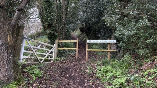
Le Ruelle ès Biches
This footpath crosses a road after a short distance but continue straight on until you reach its end. The official name for this footpath is La Rue du Poullier, meaning ‘a hen-house’, no doubt associated with a nearby farmstead. At the end of the Millennium Walk, there is field called La Couvent Camp, meaning ‘convent’. This place name suggests it was once a religious site.
Turn left into La Rue des Câteaux
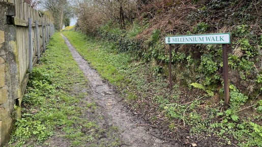
Millennium Walk
This lane leads you to an historic property named Les Câteaux, from the Latin word ‘castellum’ meaning a fort. The house is named after a medieval earthwork close by. Look out for the unusual stone basin that has been built into the stone wall to the left of the entrance to Les Câteaux. It is positioned directly below the datestone. This was originally a bénitier, a basin for holy water at the entrance to a church where a person would dip their fingers and make the sign of the cross.
Turn right and then immediately left into La Rue de la Falaise.

A bénitier
The high bank on the right is the remains of an extensive medieval earthwork known as Les Câteaux or Le Châstel Sédement. It was probably used as a place of refuge during enemy raids on the Island in the early medieval period, and is estimated to have measured 250-300 metres at its widest point.
Turn left into La Rue du Câtel.
At the junction of the two roads stands a very fine Georgian property called Belle Vue with associated farm buildings including a dower house, hay barn, pigsties and stables.
Walk along La Rue du Câtel and at the end of the road turn right into La Verte Rue.

Belle Vue
After a short distance turn left onto La Rue des Travers.At this end of this lane, turn right to re-join La Rue du Mont Pellier and head back towards Trinity Church.
When you reach the main road, pause a moment and look left to admire the attractive roadside wall and gate of La Maison Maret, a very fine property dating from the 16th century. This was once home to Charles Maret who was Connétable (Constable) of Trinity from 1725-31.
To the right, spot the historic green and white sign post standing next to the iconic black and yellow AA box. This sign post was one of a series, in a variety of styles and materials, erected around the Island in the early 20 th century in response to the growing number of motor vehicles. This particular style of sign post was made of cast iron by local iron founder J. Couilliard and was used in the parishes of Trinity and St Lawrence.
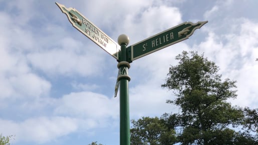
Sign post
The AA call box is a rare survival of the characteristic boxes once known as ‘the lighthouses of the road’. They were installed by the Automobile Association (AA) and were originally used as sentry boxes to make motoring about the countryside safer for everyone. AA watchmen (who were called sentries) manned the booths. They stood at the ready to serve any travelling
member of the Automobile Association. Later, they were used as call boxes.
A stranded motorist had to do nothing more than call and give the number of the kiosk, and help was on its way. This particular example dates from the 1950s.
Why not stop for refreshments at the Trinity Arms before heading home.
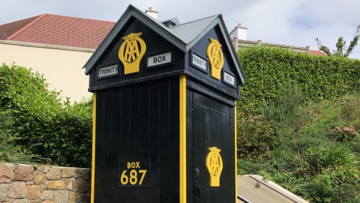
AA call box
What's On
Jersey Island Geopark Visitor Centre
The free Visitor Centre will help you to understand and explore Jersey.
Places to Visit
Hamptonne Country Life Museum
A picturesque country farm estate from the 15th century sharing the story of Jersey’s rural life.


